
Image:St Helens map showing 1980 eruption deposits.jpg
|
|
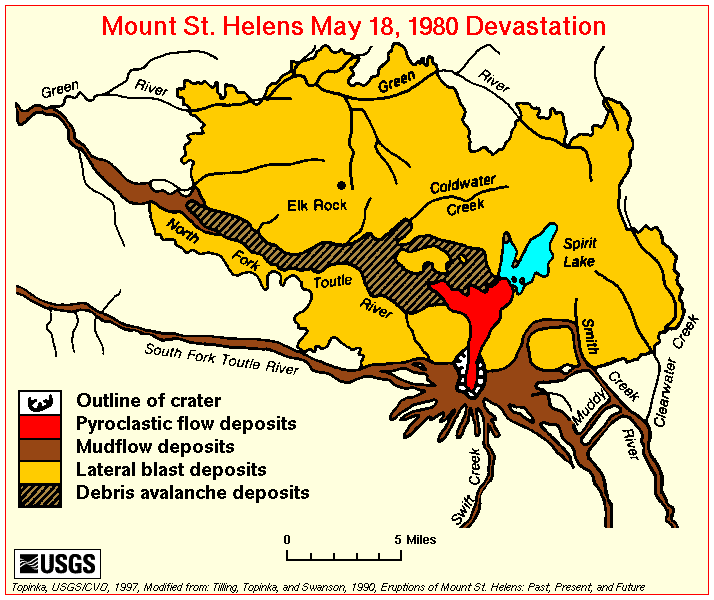
Map of the area around Mount St. Helens which were affected by the May 18, 1980 eruption. North is to the top.
USGS image from [1] (http://vulcan.wr.usgs.gov/Volcanoes/MSH/SlideSet/ljt_slideset_old.html) Template:PD-USGov-Interior-USGS
File links
There are no pages that link to this file.