
Image:Metro manila map.png
|
|
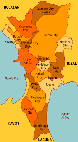
The image depicts a map of Metro Manila showing all the cities and municipalities in it. The borders are accurate for 1999, when the area of Fort Bonifacio was under the jurisdiction of Makati City instead of Taguig as it is today.
Image created by seav. Released into public domain.
| Missing image PD-icon.png Public domain | This image has been released into the public domain by the copyright holder, its copyright has expired, or it is ineligible for copyright. This applies worldwide.
|
File links
There are no pages that link to this file.