
Image:EU map names isles.png
|
|
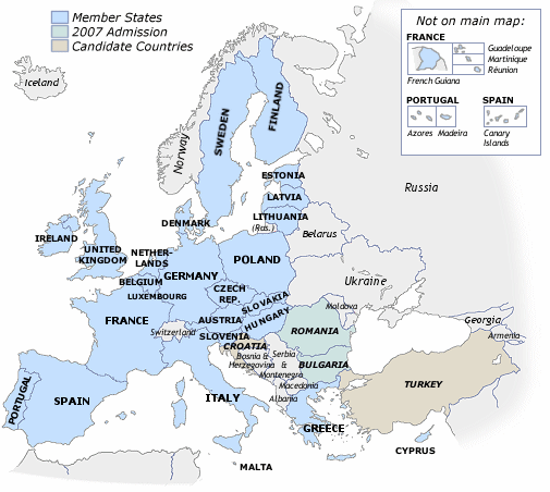
Based on existing Europe map. Attempt at a clearer map of the European Union and its neighbours (also candidates). Includes outlying EU member-state territories. (Only those considered part of home country). Inclusion as on Euro banknotes, but also including Cyprus. Blank version.
Missing image Heckert_GNU_white.png | Permission is granted to copy, distribute and/or modify this document under the terms of the GNU Free Documentation License, Version 1.2 or any later version published by the Free Software Foundation; with no Invariant Sections, no Front-Cover Texts, and no Back-Cover Texts. Subject to disclaimers. |
fr:Image:UE carte membres.png ga:Íomhá:Aontas Eorpach tiortha oileain 256.png is:Mynd:Aðildarlönd ESB.png hu:Kép:Europaiunio.png zh:Image:European Union no rivers territories 16 fan.png
File links
There are no pages that link to this file.